Construction
Whats on this page?
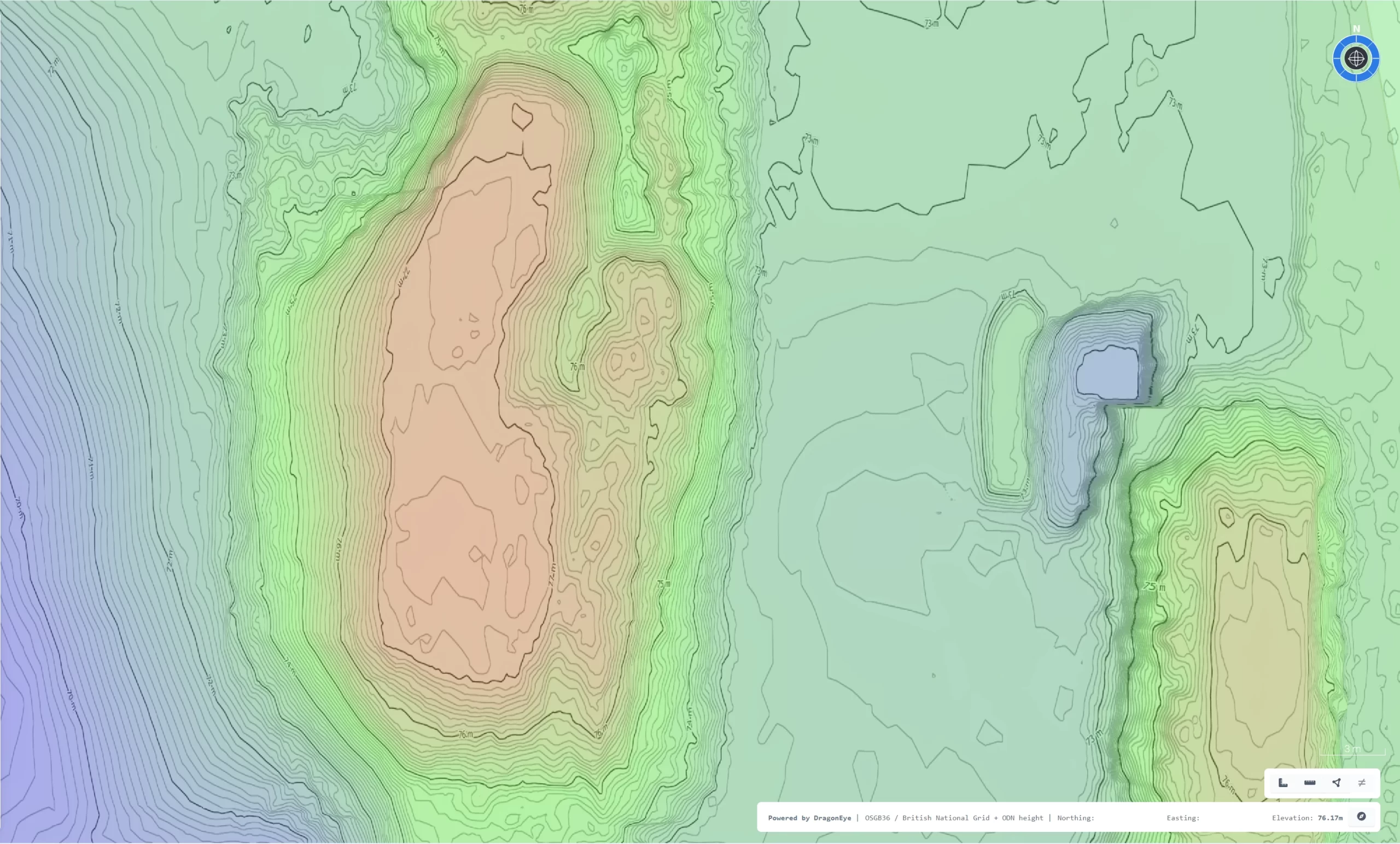
Survey Grade Topographic Data
Survey Grade Topographic Data
Precise Terrain Data For Informed Decisions
Heli-Tele enables construction teams to capture survey-grade topographical data with speed and precision. Using drones equipped with advanced imaging sensors, we deliver centimeter-level detail across entire work areas. This highly accurate terrain information enhances planning, design validation, and resource allocation, ensuring every decision is based on a solid foundation of reliable site knowledge.
Solve The Speed Accuracy Paradox
Solve The Speed Accuracy Paradox
End To End Data Capture For Maximum Efficiency
Balancing speed and accuracy in site surveying can be challenging, but Heli-Tele provides an end-to-end data capture solution that simplifies the entire process. By utilising RTK technology, our Digital Ground Control Points, and a high-precision drone, we streamline survey workflows. Our advanced data processing pipeline enables detailed surveys to be completed in a fraction of the time previously required. The result is timely, reliable data that keeps you agile and competitive in a fast-paced industry.
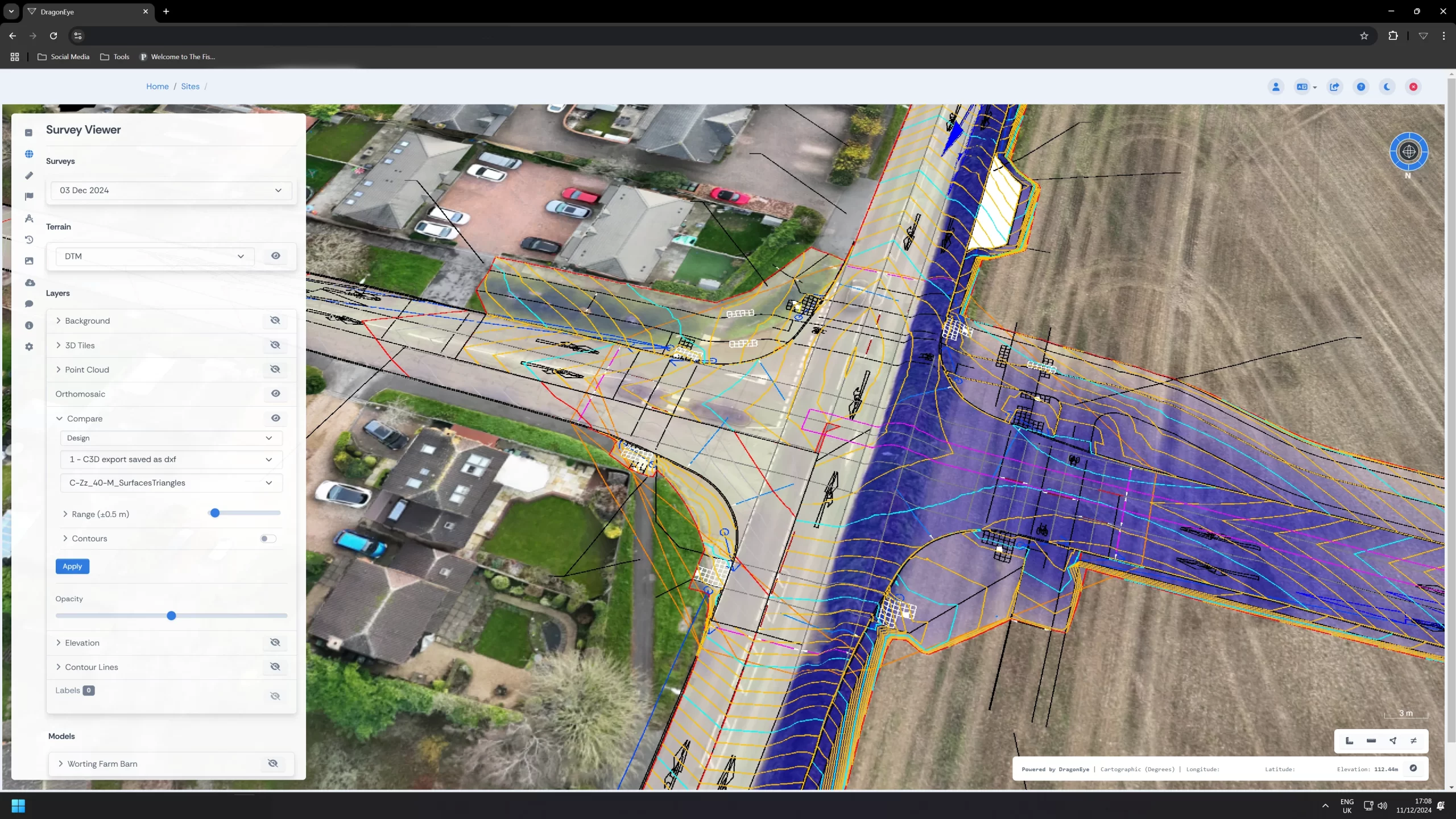
Know Your Site, Inside Out
Know Your Site, Inside Out
Complete Visibility Through Advanced Visualisation
Our integrated platform transforms raw survey data into easy to understand maps and models, allowing you to explore every corner of your site in detail. High resolution orthophotos and interactive 3D models give you a clear picture of the ground conditions, structural elements and environmental features. Understanding your construction site inside out reduces uncertainty and ensures that everyone from managers to on site teams is working from the same informed perspective.
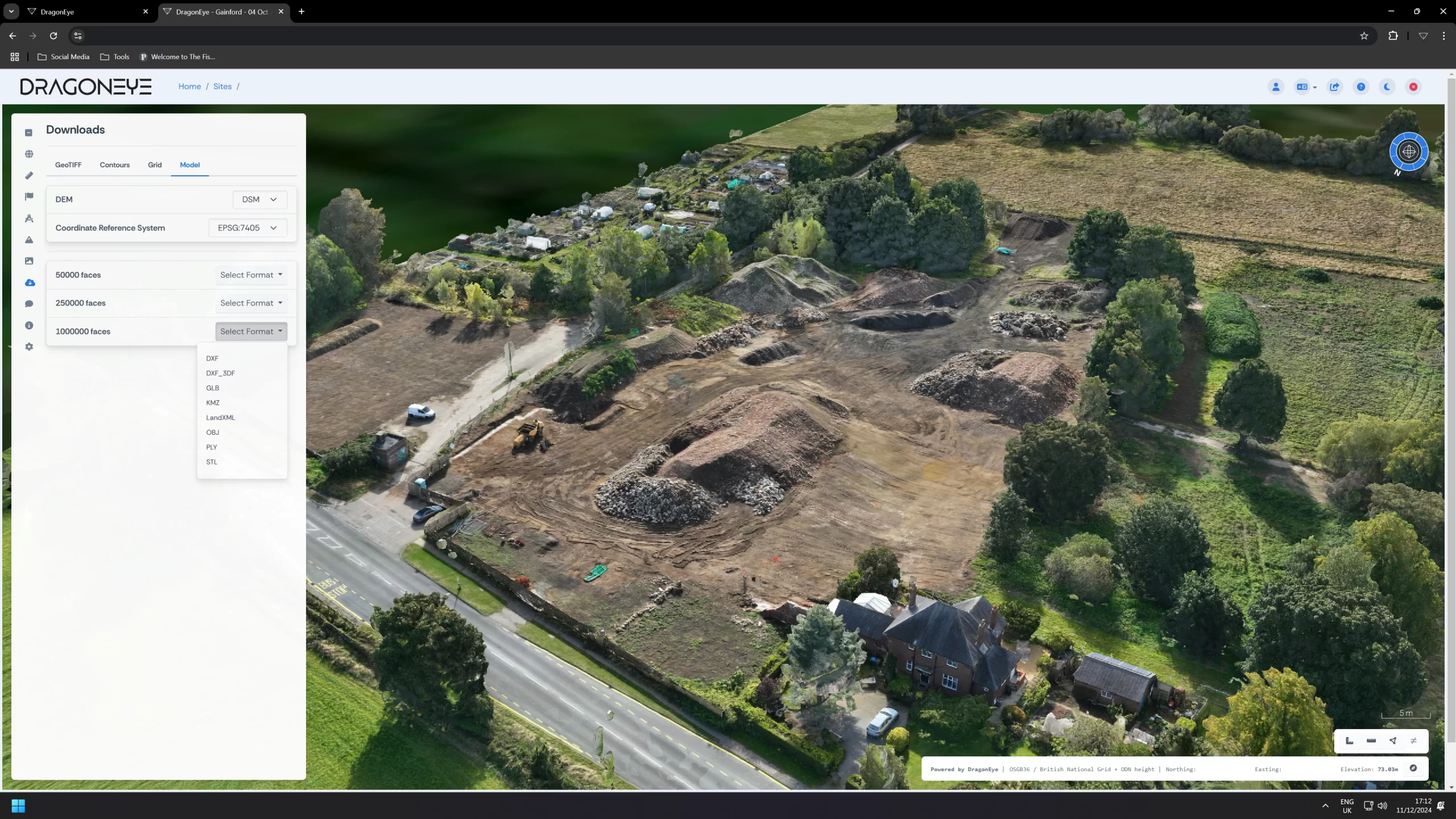
Access On Demand Quantities
Access On Demand Quantities
Real Time Insight From Any Device
Heli-Tele puts essential quantity data at your fingertips, wherever and whenever you need it. Whether you’re in the office, on-site, or meeting with stakeholders, our secure online portal allows you to quickly review material volumes, completed work, and outstanding tasks. With seamless device compatibility, you can confidently adjust plans, forecast requirements, and keep projects on track, no matter where you are.
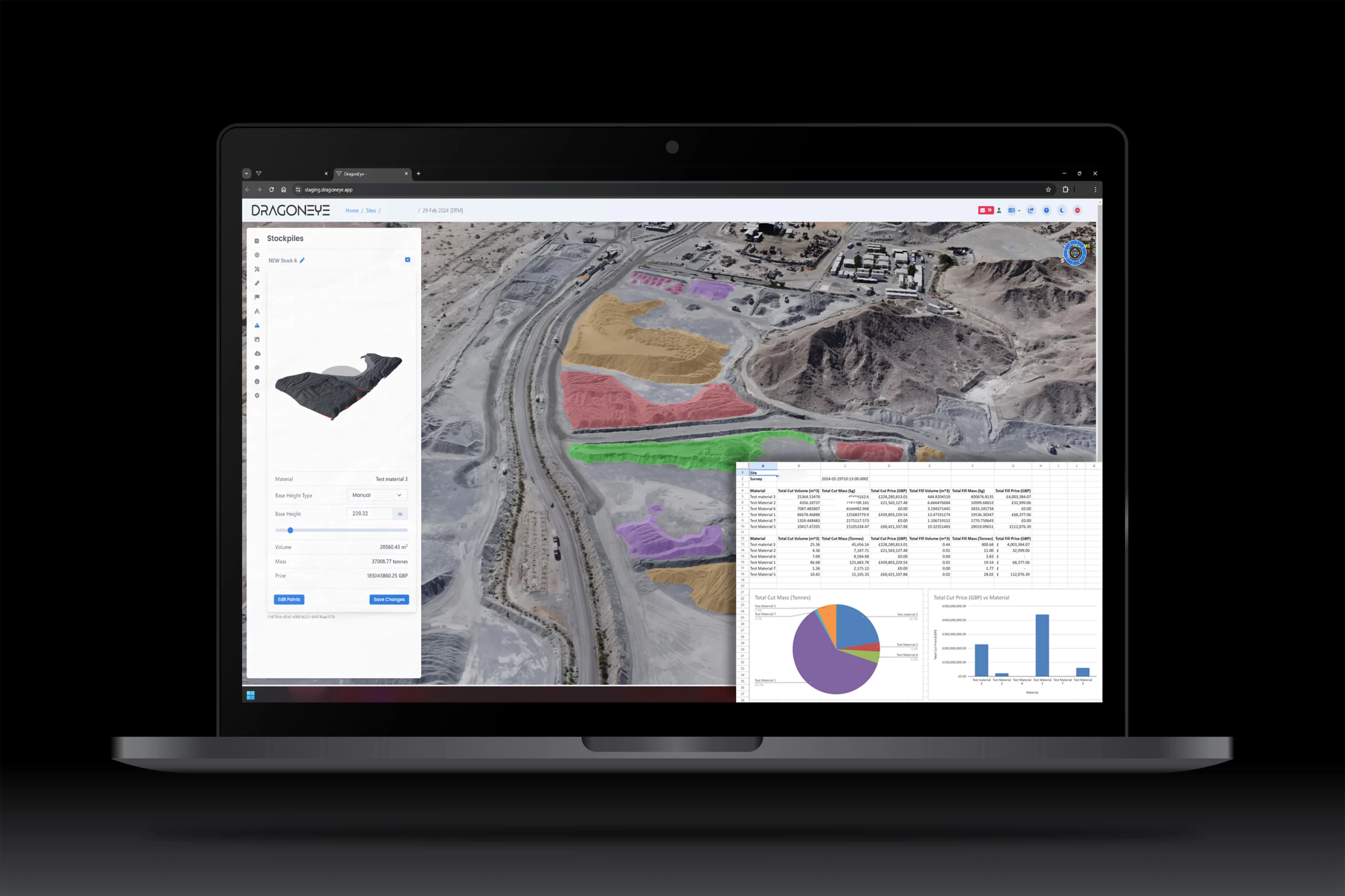
Track Earthworks Progress
Track Earthworks Progress With Ease
Monitor Your Schedule, Budget And Resources
Monitoring earthworks closely is crucial for maintaining project timelines and controlling costs. Heli-Tele provides precise measurements of cut and fill volumes, allowing site managers and engineers to assess progress and refine estimates. By identifying changes early, you can prevent overruns, optimise resource management, and ensure each stage of the construction process proceeds seamlessly.
Keep Your Site On Record
Keep Your Site On Record
A Comprehensive Archive For Transparency
Safeguard your interests by maintaining a thorough record of site conditions and activities throughout your project’s lifecycle. Heli-Tele systematically archives terrain data, imagery, and key performance indicators, providing a dependable reference for future queries or claims. In the event of issues or discrepancies, this impartial historical record facilitates swift and fair dispute resolution, promoting trust and accountability among clients, contractors, and regulators.
Generate And Share Reports
Generate And Share Reports In Seconds
Streamlined Communication For Better Collaboration
Time is invaluable, especially on a construction site. With Heli-Tele, producing professional reports on site progress, material usage, or compliance metrics is fast and straightforward. In just a few clicks, you can create customisable summaries featuring imagery, volumetric data, and notes. These clear and concise reports foster transparent communication among project stakeholders, ensuring everyone remains informed, aligned, and ready to act.
Level Up On Site Safety
Level Up On Site Safety
Proactive Risk Management Through Better Insight
A safer site promotes a more efficient and productive workforce. Heli-Tele’s high-resolution models empower site managers to pinpoint potential hazards, minimise worker exposure to unstable terrain, and plan safer routes for vehicles and equipment. By addressing risks early, you can enhance on-site training, improve compliance with health and safety regulations, and ensure a secure environment for all personnel.